Satellite, drone and AI — one architecture
A three-layer data architecture: satellite delivers the macro view, drones capture micro detail, and AI extracts meaning from every pixel. The result is measured data you can act on.

A three-layer data architecture
From macro satellite to micro drone detail, then on to AI inference — each layer feeds the next and converges in a single decision engine.
Satellite Layer
Macro ImagingSpace-based sensing for large-scale, periodic observation. Cloud masking and mosaic stitching resolve the problem of discontinuous data.
- +Sentinel-2: 10 m resolution, 5-day revisit
- +Pléiades Neo: 30 cm resolution, daily tasking
- +WorldView-3: 31 cm, multispectral bands
- +SAR radar (Sentinel-1): cloud and night conditions
- +Change analysis across multi-temporal series
Drone Layer
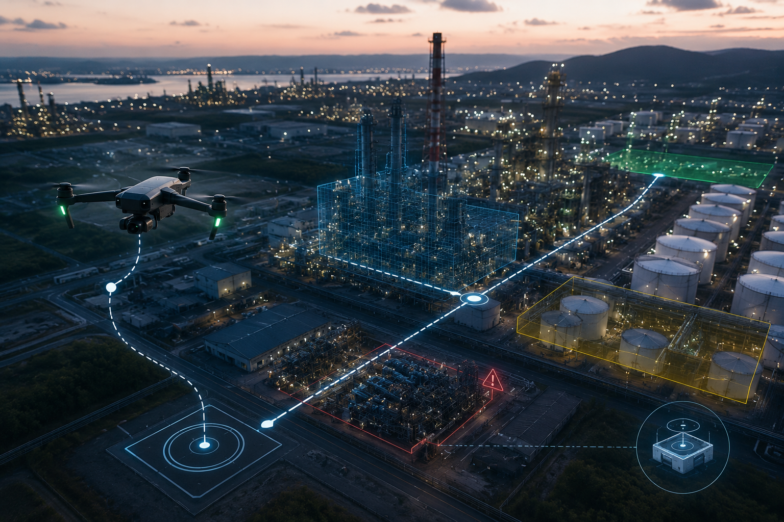
Micro SensingCaptures the detail satellites cannot see. Pilotless operation via an autonomous dock station; the on-site station is ready at any moment.
- +Commercial-grade RTK drone: heavy payload
- +Autonomous dock: charging, take-off/landing, BVLOS
- +0.5 cm/pixel RGB resolution
- +Thermal camera (−20°C to +1500°C)
- +LiDAR: 3D point cloud, mm precision
AI Layer
Decision IntelligenceFrom raw data to insight. Object detection, change analysis, BIM matching, agricultural indices — all powered by machine-learning models.
- +YOLOv8: object detection (vehicle, person, helmet, structure)
- +Semantic segmentation: land-cover classes
- +Change detection: pixel differences across two dates
- +BIM overlay: 3D model to scan matching
- +NDVI / NDWI / EVI: agricultural spectral indices
Pilotless, uninterrupted field operations
A field-mounted dock station runs the drone's entire cycle: take-off, mission, landing, charging. No pilot, no daily check-ups — ready in any condition.
- +Autonomous take-off, mission, landing and charging cycle
- +Full control from a remote operations center
- +BVLOS (beyond visual line of sight) authorized flight
- +City / terrain coverage via a multi-dock network
 INDUSTRIAL SITE · NIGHT OPERATION · BVLOS
- ±1 cm
- RTK accuracy
- 0.5 cm
- Pixel resolution
- 10 km+
- Operating range
- 24/7
- Autonomous cycle
Traditional method vs Vechür
- Survey time per 1,000 m² 2–3 days2–3 hours
- Annual operating cost ~₺400,000~₺60,000
- Accuracy ±30 cm±1 cm
- Scan frequency 1–2 per yearWeekly/monthly
- Field personnel 5–10 people1 pilot + remote
- Archive Paper / PDFDigital, comparable
- Night operation NoneThermal camera
- Reporting time 1–2 weeksSame day
The AI models we use
Models trained and fine-tuned specifically for each sector — proven architectures from open literature, adapted with the Vechür dataset.
YOLOv8 Object Detection
Real-time object recognition: vehicle, person, helmet, vest, structure, tree. Runs on video and photo streams.
Semantic Segmentation
Predicts the class of every pixel. Land-cover mapping: structure, road, vegetation, water, bare soil.
Change Detection
Compares imagery from two different dates. What changed, where and by how much, at the pixel level.
BIM Overlay
Overlays a 3D BIM model onto photogrammetry data. As-built vs as-designed deviation at millimeter accuracy.
NDVI / Agricultural Indices
Agricultural indices from multiband imagery: NDVI, NDWI, EVI, SAVI, CIre and more.
From drone to dashboard
- 01 / 06
Data Collection
Raw drone and satellite imagery plus positional data.
- 02 / 06
Edge Processing
On-board preprocessing and filtering on the drone.
- 03 / 06
Cloud Transfer
Instant, secure data upload over 5G.
- 04 / 06
AI Analysis
Model inference, labeling and index computation.
- 05 / 06
Dashboard
Visual maps, layers and technical reports.
- 06 / 06
Notification
Integration into your systems via WhatsApp / API.
Let's
Work Together
Share your project and needs, and we'll offer you a tailored solution.